Tag Archives: south island

Christchurch – Part 3

Still in deep lockdown… So don’t really want to talk about anything too dark today. Actually, I want to show you the ways that Christchurch has rebuilt itself in the time following the disaster.

In my previous post, I concentrated on the ruins, and you might remember seeing the ruins of the Anglican Cathedral. The people of Christchurch didn’t want to be without a place of worship for too long, so they quickly commissioned the Cardboard Cathedral, which was opened 2.5 years after the earthquake.

Christchurch CBD Creativity

It’s a very creative and positive building to enter, and when we visited there was a lot of activity. It was supposed to be temporary, but I heard they’ve decided to make it a permanent fixture for the city.

In other places around the city they’ve planted gardens where there were buildings. This one is a memorial garden in the place where the CTV station building was.

Christchurch CBD Creativity

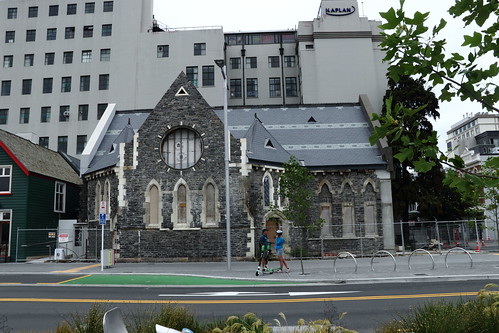
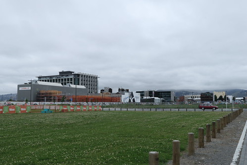
Other places are getting rebuilt in typical 2010’s style.

Christchurch CBD Creativity

However there are places that are a little more innovative. Christchurch is famous for its use of shipping containers as structures.

Christchurch CBD Creativity

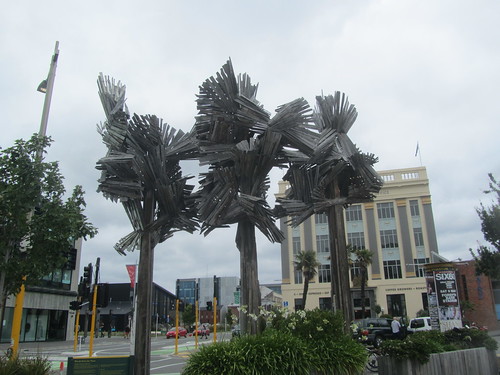
And some interesting sculptural elements.

Christchurch CBD Creativity

Christchurch CBD Creativity

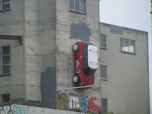
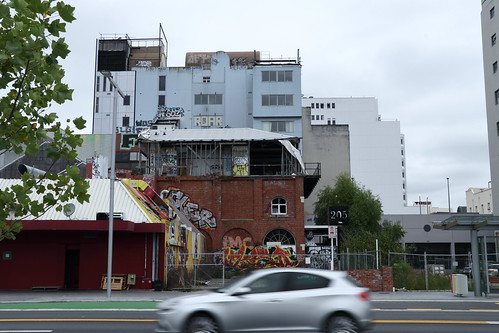
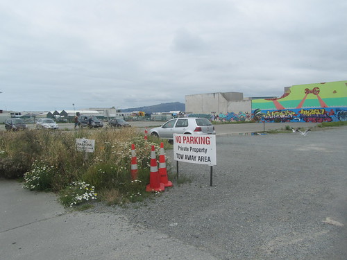
And finally there’s a proliferation of street art everywhere you look, on old and new buildings.

Christchurch CBD Creativity

Christchurch CBD Creativity

Christchurch CBD Creativity

Christchurch CBD Creativity

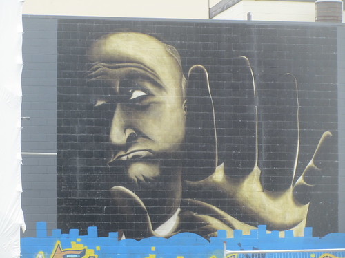
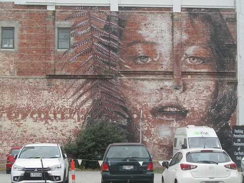
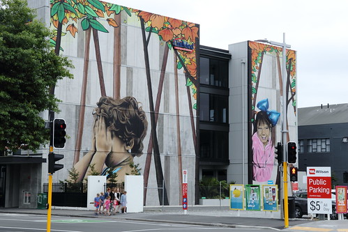
The combination of all this artwork is very moving. It shows a city that’s rebuilding itself using art. We can learn a lot from that.

Christchurch – Part 2

Walking around the CBD at Christchurch in 2018, I was of course struck by the level of devastation that the earthquake had caused. But in saying that, I was also struck by the things that have survived.

Christchurch 2018

Christchurch 2018

Christchurch 2018

Looking at these photos, it was reassuring that the old-time pioneers built such hardy buildings.

Christchurch 2018

Christchurch 2018

And even when the buildings were damaged, the fact that they survived in some form (as in the case of the Anglican Cathedral) is astonishing.

Christchurch 2018

Christchurch – Part 1

After following the alpine rivers to the coast, it was a case of retracing our steps back to the city of Christchurch. We’ll concentrate a bit on Christchurch here. Few people can visit this city in 2018 and emerge unmoved.

On Tuesday, 22nd of February, 2011, the city was hit by a 6.2 earthquake whose centre was a mere 7km from the CBD. This was after 7.1 earthquake hit the area some 5 months before. What resulted was utter devastation, and though we visited almost 8 years after the earthquake, what happened in 2011 was still all around in the vacant lots that were waiting to be rebuilt.

Christchurch 2018

Christchurch 2018

Christchurch 2018

Christchurch 2018

But I don’t want to dwell solely on the tragedies, because I think it’s the creative and vibrant ways that the locals found to get back on their feet – things that can be found around almost every corner – that really made our visit. I’ll write about some of these little things in this series.

From West to East – Part 4

So it’s downhill from the crest of Lewis Pass, but no time to get distracted as there’s the odd landslide to dodge.

Driving Lewis Pass

And a few twists and turns.

Driving Lewis Pass

Here, the road follows a series of rivers. First the Lewis, then the Nina, the Boyle, the Hope, and finally the Waiau Uwha, as it makes its way to the Pacific Ocean.

Driving Lewis Pass

Driving Lewis Pass

We travelled in early summer, so the rivers weren’t flowing full-pelt. It must be exhilarating to see it in full force in the spring time.

From West to East – Part 2

We’ll continue driving from the west coast to the east coast of the South Island.

Driving Lewis Pass

Our route took us through the small town of Reefton. It is another former gold-rush town (where they found an extensive gold-bearing quartz reef, hence the name).

Driving Lewis Pass

If it looks and feels like the ‘wild west’ then you’re not far wrong.

Driving Lewis Pass

Probably because the first gold was found in 1866, just after the Australian gold rushes started and not long after the Californian gold rush that opened up the American ‘wild west’. They all probably employed the same architects.

Driving Lewis Pass

Because of the riches of the gold mines, and also the power of the nearby Inangahua River, the town was the first in the Southern Hemisphere to be connected to the electricity grid, courtesy of the Reefton Hydro Power Station.

From West to East – Part 1

The last big drive of our South Island trip was from the West Coast town of Westport to the East Coast city of Christchurch. We took the most direct route, through Lewis Pass.

Because I did most of the driving on the day, Hubby decided to document the day by taking lots of photos. It was a good thing he did because I was concentrating so much that I probably wouldn’t be able to recall much of the drive if it wasn’t for these photos. It also shows to you readers who haven’t been to New Zealand as yet what typical Kiwi road conditions look like. Now that the travel bubble between Australia and New Zealand is up, some of you might be thinking about having a holiday across the ditch. I say, go ahead, but be aware first and don’t take on too much. It’s not like driving from Sydney to Melbourne down the motorway.

How different is it? Let’s start our journey.

The first section of the journey follows the very pretty Buller River.

Driving Lewis Pass

The road is a typical Kiwi road, one lane each way. This gets even tighter in one section of the road, where it’s one lane full-stop, as the road has been hewn out of the cliff.

Driving Lewis Pass

Now, with a single lane, you hope that there isn’t anything large passing the other way, like a double tanker.

Driving Lewis Pass

Luckily that didn’t happen to us, however it didn’t mean that it wasn’t nerve-wrecking…

Pancake Rocks – Part 1

One day trip we did on the West Coast is to drive an hour south of Westport to the village of Punakaiki. The drive down required a lot of concentration as the west coast road was very windy (aren’t they all?) but despite the bleak weather, I think it was worth the drive to see Pancake Rocks.

Pancake Rocks

Pancake Rocks

The rocks were quite unique in that the do look like pancakes. There’s of course a scientific explanation to all of this, and like most things geological it’s not the work of an instant.

Pancake Rocks

Denniston – Part 2

Let’s continue exploring Denniston. Being on a plateau, a good 600 meters above the township of Waimangaroa and where the railway line stood, it took a bit of work to get the coal down to the trains for transport.

Denniston Heritage Site

They had a few ways of getting down. There was the road, but that was not very efficient, being winding, narrow, unpaved and so very dangerous. So they built a cable railway straight down the hill that was eventually called the Denniston Incline.

Denniston Heritage Site

Gravity would move the filled wagons down the hill and also pull any empty wagons back up.

Denniston Heritage Site

You can probably tell that it wasn’t the safest of ways to transport a fully-laden coal wagon, especially when the wagon derails, which was rather quite often apparently. Since no adult wanted to lose their life down the hill, the ‘drivers’ of these wagons were often young boys of 12 or 13 years old.

Well, that’s all from Denniston. Mining is still going on in the area, but on a hill some 20km further north. I hope today they’ve got a less dangerous method of transportation.