Tag Archives: photos

Another Winter Visit – Part 1

Last year’s visit to Jamberoo Abbey took place in mid-winter. I was up bright and early the first morning to watch the sun rise.

Winter Visit

The cattle were in the paddock closest to the cottages, which was a bonus to the photographer.

Winter Visit

They looked to be mainly black Anguses, and were busy breakfasting…

Winter Visit

When an interloper appeared out of the bush.

Winter Visit

The bovines weren’t quite sure of the wombat.

Winter Visit

And neither was the wombat completely comfortable to be so exposed. After a few nibbles of grass it wandered back to safety.

Winter Visit

Nitmiluk Gorge – Part 4

The rainstorm lasted less than ten minutes – brief like most Northern Australian storms. The clouds very soon cleared, and it was as if it had never been.

Cruising Nitmiluk Gorge

As we cruised back to our starting point, we were able to enjoy some beautiful afternoon light, and temperatures that were 10C lower than when we started.

Cruising Nitmiluk Gorge

Then it was back to the train, ready for our next off-train adventure.

Barangaroo – Part 2

At the northern end of Barangaroo is the newly-opened Barangaroo Reserve. Yes, it’s parkland that’s been added back into the city!

Barangaroo

It’s been landscaped with thousands of sandstone blocks that have been quarried from the site, and planted with species that are indigenous to the peninsula. It salutes its indigenous past with many Aboriginal place names on the site.

Barangaroo

I love the sandstone blocks which came in all shapes and colours.

Barangaroo

Barangaroo

The park also has great views of the harbour, down to the Anzac Bridge.

Barangaroo

And across Walsh Bay to the Harbour Bridge.

Barangaroo

When the entire Barangaroo is open, we’ll be able to walk along the entire foreshore from Woolloomooloo all the way to Darling Harbour. I think it’s a brilliant addition to the city.

Barangaroo – Part 1

Sydney is a city that changes all the time, and the western part of the CBD is an area that has changed the most. It’s been named Barangaroo, named after the wife of Bennelong, a powerful Cammeraygal woman, and wife of Bennelong, who lived at the time of first European contact. The point was part of the land of the Cadigal people, and the shores of Darling Harbour was an important site for collecting cockles and oysters.

The area was gradually used as a port area in the 19th Century, and was seized by the government at the turn of the century for sole use as a port. It was abandoned in the late 20th Century when changes in shipping required a much larger port, and Sydney’s port was moved to Botany Bay.

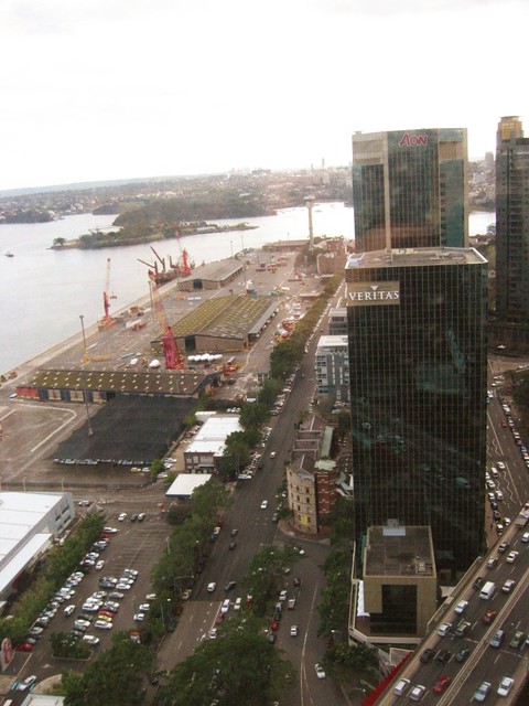
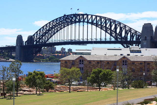
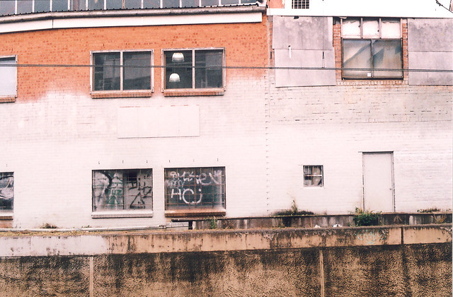
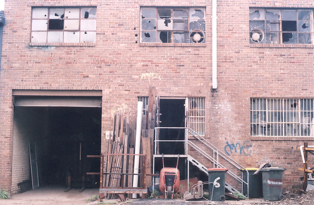
In 2006, this was how the area looked. Most of the previous buildings have been knocked down, just a few warehouses left.

Barangaroo

The area was then cleared in preparation for Catholic World Youth Day in 2008.

Barangaroo

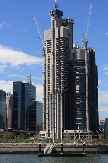
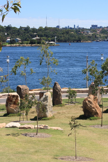
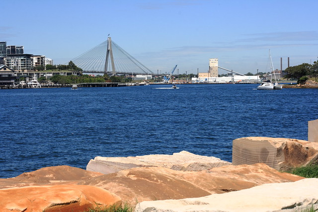
Nowadays, the site looks completely different. The southern part of the site is now dominated by new skyscrapers that completely dwarf the buildings around it.

Barangaroo

However, it is the northern half that I like the most. More in the next post.

By the Tracks – Part 5

Walking east of Kingsgrove Road towards Bexley North, we come to a pedestrian tunnel.

Kingsgrove Project

It links streets to the north and south of the M5. There are a few of these along the track, very handy as otherwise it would be a very long walk to the train station for those living north of the M5.

Kingsgrove Project

Wolli Creek once again winds its way downstream. It runs into the Cooks River, past the airport, and into Botany Bay.

Kingsgrove Project

With the arrival of the M5 the canal was widened, but it hasn’t eased the flooding. Why does it flood so often? I Googled this issue and found a Flood Study for the area. It says that before this part of Sydney was settled, all the rainwater was slower to enter the creek, having to be filtered through the soil or flow down the numerous gullies and creeks. Now there is a lot more concrete, meaning less places for water to filter through, hence more flooding. Judging from the amount of flooding recently in Sydney and its surrounds, this is very common side-effect of urbanisation.

That ends our little tour of the M5 and Kingsgrove. I enjoyed photographing the suburb and writing about it, so perhaps I might do it again somewhere down the track.

By the Tracks – Part 4

It’s not all concrete in this industrial complex. There’s a touch of green around too.

Kingsgrove Project

It’s not exactly the tropics here, but banana trees seem to grow really well.

Kingsgrove Project

Kingsgrove Project

You don’t exactly see the M5 from the track as hear it. The roadway is on the other side of the trees.

Kingsgrove Project

The canal that you see there is the infamous Wolli Creek. In heavy rains (and it has been heavy often lately) the creek can swallow up cars, even trains.