Tag Archives: walk

Sandstone Country – Part 5

We had quite a few encounters with the wildlife in Sandstone Country. Being a place with many nooks and crannies, there were many places for creatures to hide.

The smallest first – these green tree ants were definitely the most ubiquitous. Their green bums have a lemon taste, and most tour guides in Northern Australia will coerce encourage you to taste it.

Creatures of Sandstone Country

This little beetle (or is it a bug?) had an almost jewel-like shell.

Creatures of Sandstone Country

These St Andrew’s Cross spiders were almost as ubiquitous as the green tree ants. Thankfully, they’re not poisonous.

Creatures of Sandstone Country

But the most striking small creature was the Leichhardt Grasshopper, first recorded by explore Ludwig Leichhardt back in in his first expedition through the Top End. He lived to mount a second expedition, where he mysteriously disappeared!

Creatures of Sandstone Country

Late Summer Beach Walk

Before the wet weather set in, we took a late afternoon walk at Umina Beach to enjoy the clear views across Broken Bay to Lion Island.

Late summer beach walk

The water was warm but had a bit too much weed and jelly blubbers for my liking for swimming.

Late summer beach walk

The wind was certainly up that day, so it was a parasailer’s paradise.

Late summer beach walk

Of course, every day is a good day for dog walking. Once again, fur children of all shapes and sizes were in force along the beach, and generally getting on quite well together.

Late summer beach walk

The Girrakool Loop – Part 2

The trees on the Girrakool Loop had some interesting details. This one had stripes on it.

Girrakool Loop Walk

And this log had bark that was as red as the outback sands.

Girrakool Loop Walk

There were some wildflowers out, the most striking being this mountain devil.

Girrakool Loop Walk

Eventually, the track met up with Leask and Piles Creeks. These waterways run into the Hawkesbury.

Girrakool Loop Walk

As we made our way back uphill towards the picnic area, we encountered a few little cascades and cool patches of rainforest.

Girrakool Loop Walk

A nice little walk through the Sydney Basin bush.

The Girrakool Loop – Part 1

We discovered a new little walk not too far from Umina – the Girrakool Loop. It’s in the Brisbane Waters National park near Kariong, very close to the freeway, but so well-hidden that only the locals know of this spot.

Girrakool Loop Walk

There is a picnic area and car park at the start of the track, so the walk might be a good way to start/end a day out.

The track winds its way through the bush, across rock platforms with mature grass trees.

Girrakool Loop Walk

And under great Sydney Red Gums.

Girrakool Loop Walk

It was shedding time, so the scribbly trunks were well exposed on some trees.

Girrakool Loop Walk

While on other trees the blood-coloured sap was flowing.

Girrakool Loop Walk

At Cape Point

We finally made it to Cape Point, the most south-westerly point of Africa. But there was still some walking to do up to the lighthouse.

At Cape Point

At Cape Point

Many people cheated and took the Flying Dutchman Funicular instead, but that would take away from the sense of accomplishment at reaching the top, I thought.

At Cape Point

And a chance to catch my breath along the way while taking in more of the marvelous views.

At Cape Point

At Cape Point

At the lighthouse, there was the obligatory direction post. We’d travelled a long way from Sydney, that’s for sure.

At Cape Point

That’s the end of our Cape Point adventure. But I’m not done with South Africa just yet.

Day out in the Illawarra – Part 1

It’s been a seriously long time since I visited the Illawarra coast line north of Wollongong. In fact, the last time I posted about the area was back in 2009!

Since then, the Sea Bridge at Coalcliff has become a bit of a tourist attraction, and on a day out with M, we decided to see what the fuss was about. We started the walk on the north end of the bridge, and walked down to the south end to get this view.

Sea Bridge

Just note that it was very windy there out on the bridge. The view of the coast was better when you’re walking south to north, but only in the morning/late afternoon/cloudy days. And do not attempt to do a ‘Titanic’, as we saw some Chinese tourists do in the middle of the bridge. I mean, really?

Jandamarra’s Path – Part 4

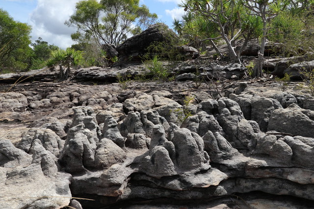
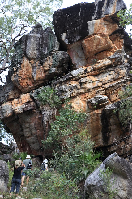
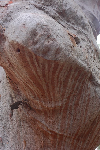
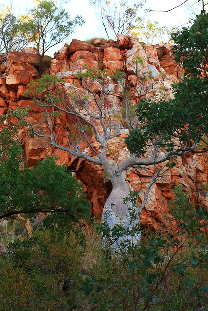
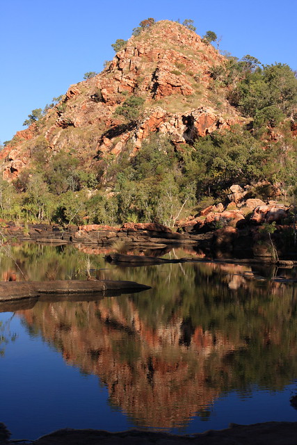
We’re on the final stage of Jandamarra’s story. After being severely wounded in the siege at Windjana Gorge, Jandamarra retreated into the hills and caves that he knew around the Napier Ranges. One of his hideouts was our next destination – Tunnel Creek. It was from here that he conducted more of his raids on the surrounding properties. The local police for years after had trouble locating him. We’ll soon see why.

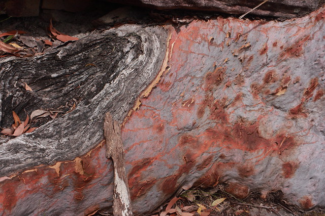
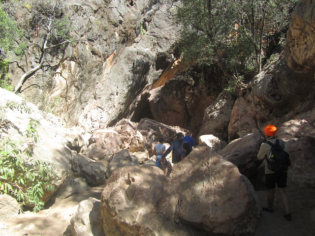
We walked along a sandy track, and then around large boulders, down to the cave entrance.

Tunnel Creek

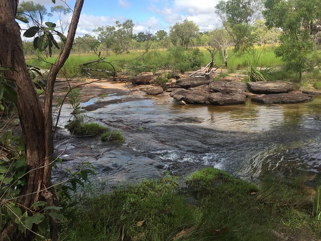
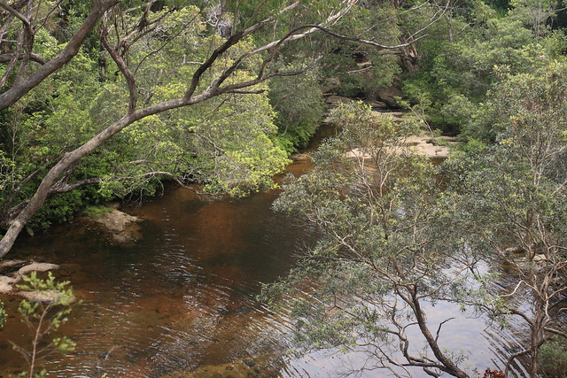
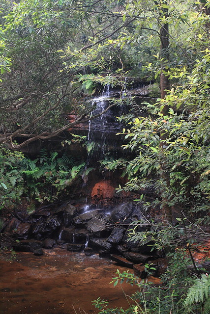
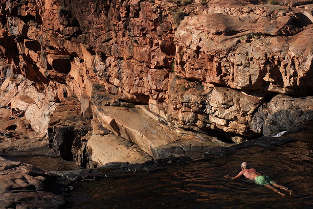
It was cool, wet and sandy inside the cave. In fact, a creek flowed through it (hence the name). It’s a sanctuary also for freshwater crocodiles in places, though we didn’t see any.

Tunnel Creek

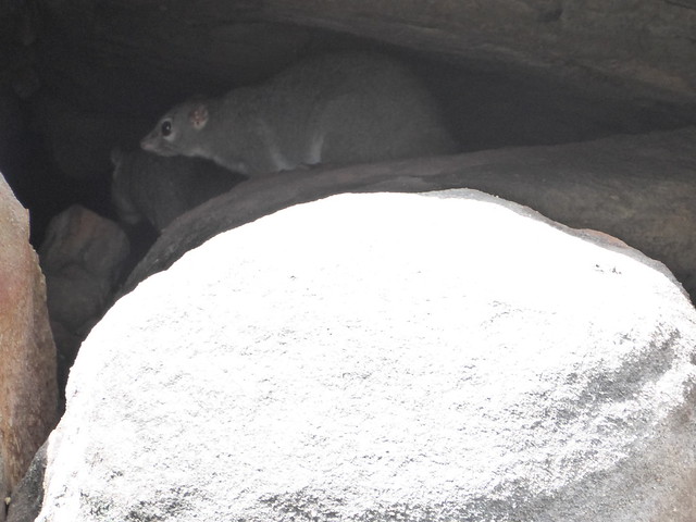
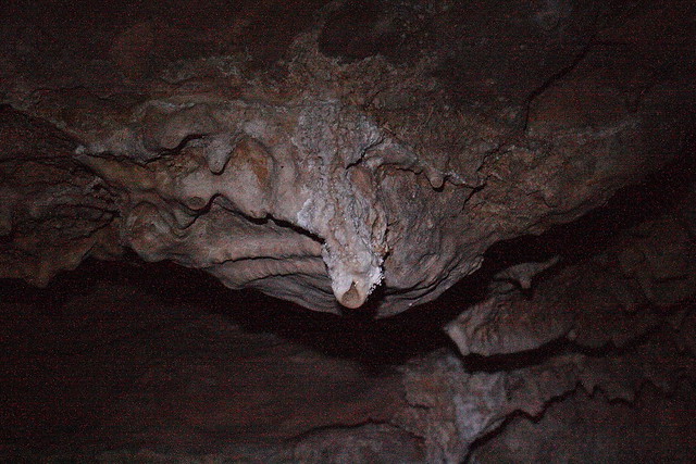
The deeper we walked into the cave, the more interesting the cave formations were. There were even some micro bats living in the rafters of some places.

Tunnel Creek

Tunnel Creek

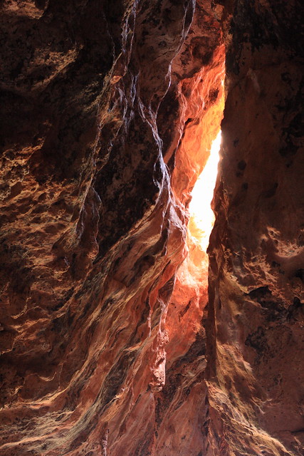
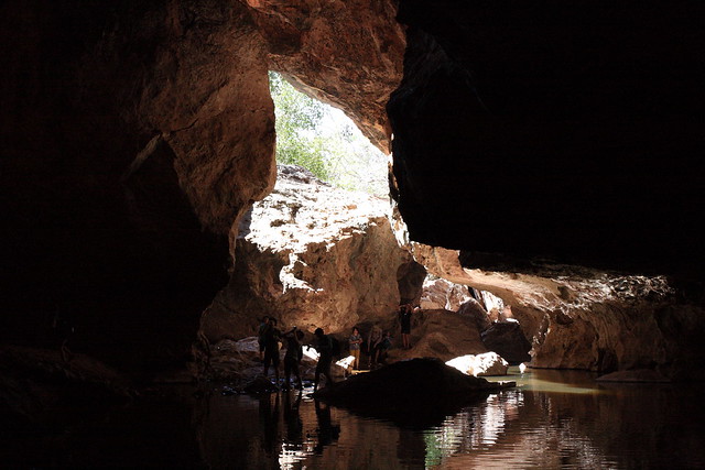
Half-way through, there was a part of the cave that had fallen in, giving us a glimpse of daylight.

Tunnel Creek

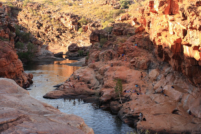
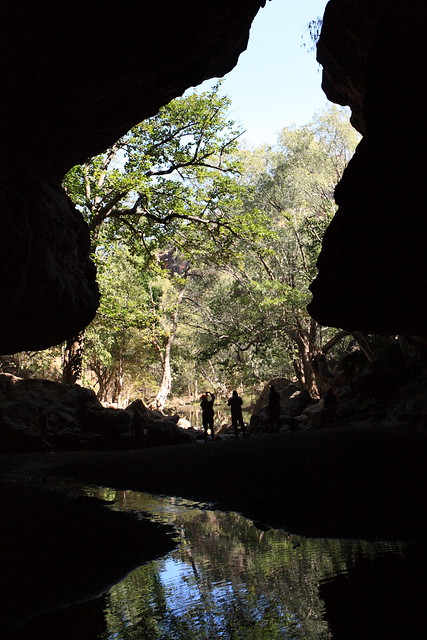
And then more daylight – we reached the opposite end and had walked right through the Napier Range! Obviously, Jandamarra used this place to great effect after his raids. So effective was he many people thought that he held supernatural powers.

Tunnel Creek

But he eventually ran out of time. The police eventually found his hideaway, and he was shot dead at the entrance of Tunnel Creek. He might have died almost 120 years ago, but his story has not been forgotten by the Bunuba people. Now others have the opportunity to learn of this piece of Australian history.

Tunnel Creek

Kimberley Swims – Part 2

Our afternoon swim was particularly scenic at the very pretty Bell Gorge in the middle of the King Leopold Range. It was about a 1km walk from the car park, and on the way we passed many a ghostly boab.

Bell Gorge

Our first glimpse of Bell Gorge was of a tranquil pool amidst the red ochre of the King Leopold Range.

Bell Gorge

Time for a dip! The pool wasn’t very deep up top.

Bell Gorge

You could even peer over the edge of the waterfall (the current wasn’t strong at all).

Bell Gorge

Others took a steep track to the bottom pool. I didn’t go however those who did said it was nice and deep.

Bell Gorge

Another nice end to the day.

Mitchell Falls – Part 5

And as a final treat, we got to ride a helicopter back to the start of the walk.

Mitchell Falls Walk

We strapped ourselves in, since the back seat was once again door-less.

Mitchell Falls Walk

But the view of the falls was priceless.

Mitchell Falls Walk

Mitchell Falls Walk

With all that blue water, you would think that the falls are a good place for a dip. You can swim, but only in the upper pools – saltwater crocodiles may be lurking in the lower pools.

We got a bird’s eye view of the track we had walked on.

Mitchell Falls Walk

And five minutes later, we touched down!

Mitchell Falls Walk

The falls (and the helicopter) was my picture of the day.

Mitchell Falls Walk