Tag Archives: photography

Kununurra and Ord River – Part 2

We explored the Ord River that morning on a cruise. It was a luxury to be the only cruise boat along its length, so that we could all appreciate the river and the early morning reflections.

Ord River Cruise

Ord River Cruise

Ord River Cruise

These scenes reminded me of those I saw in the Top End of the Northern Territory. Except at Kakadu we were sharing the lagoon with many cruise boats, while on the Ord we were practically the only ones on the river. On the way, the cruise guide pointed out the wildlife and told us about the history of the region. So pretty!

Ord River Cruise

Ord River Cruise

Bungle Bungle Walks – Part 1

The following day we drove the 53km into Purnululu National Park to see the Bungle Bungles up close. We did two walks that day – the first was to an area called Cathedral Gorge.

The walk started with a grand vista of the domes among the usual savannah landscape of low scrub and termite mounds.

Cathedral Gorge walk

Cathedral Gorge walk

The domes towered above us the further we walked into the gorge.

Cathedral Gorge walk

Cathedral Gorge walk

There were lots of interesting details to see: a close-up of the stripes, and the amazing places that termites are able to build their mounds.

Cathedral Gorge walk

Holes in the ground grinded down by rocks being caught in a whirlpool.

Cathedral Gorge walk

Giant slabs of sandstone that have fallen away due to the intense weathering in the Wet.

Cathedral Gorge walk

And at the end was Cathedral Gorge – a pool dwarfed by sheer sandstone cliffs and overhangs. The acoustics were magnificent, as the boys found out when they sang a tune.

Cathedral Gorge walk

The scenery on the walk was so inspiring that it became my picture of the day.

Cathedral Gorge walk

Outback Twilight Interlude

At twilight, we took a little walk beyond the tents and Grey Nomad caravans. The land was still, and the sky vast.

Semi Arid Sunset

The trees and shrubs came to life. This leafless acacia tree seemed to reach out at me, like a creature from the deep.

Semi Arid Sunset

Semi Arid Sunset

Then the colours kick in. This pair of boabs made a perfect silhouette to the sunset.

Semi Arid Sunset

It was so pretty that I had to capture it on paper, too.

Semi Arid Sunset

Bungle Bungles from the air – Part 3

We flew south over the hills, and the further south we went, the smaller and more pronounced the do mes became. These are where the ‘money shots’ of the Bungle Bungles are taken.

Bungle Bungles Helicopter Ride

And there are more domes to be seen up toward the horizon. The Bungle Bungles are more extensive than the iconic rocks of Central Australia, and so much more rewarding to see from the air.

Bungle Bungles Helicopter Ride

The sun soon dipped, and all too quickly we were back to where we started.

Bungle Bungles Helicopter Ride

Bungle Bungles Helicopter Ride

But that’s not the end of the Bungle Bungles – we will soon see it on foot.

Bungle Bungles from the air – Part 2

After around ten minutes, the striped hills of the Bungle Bungles appeared. The domes and stripes are all due to the movement of water through the sandstone, eroding it into domes, and leaching some layers of sediment more than others.

Bungle Bungles Helicopter Ride

Bungle Bungles Helicopter Ride

We had a great view of the domes, and peered down into deep canyons to see palms and water holes.

Bungle Bungles Helicopter Ride

Bungle Bungles Helicopter Ride

The pilot even showed us recent signs of lightning strikes – the build-up and wet seasons are particularly violent in the Kimberley.

Bungle Bungles Helicopter Ride

Bungle Bungles from the air – Part 1

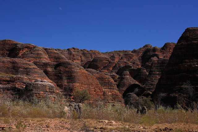
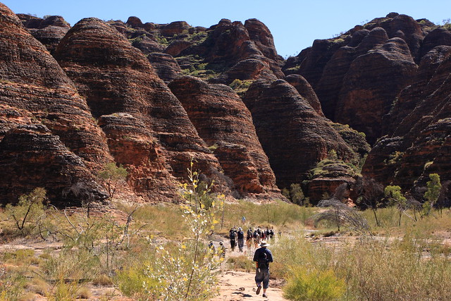
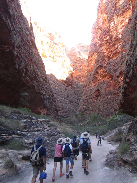
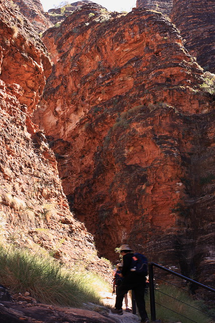
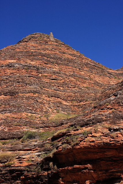
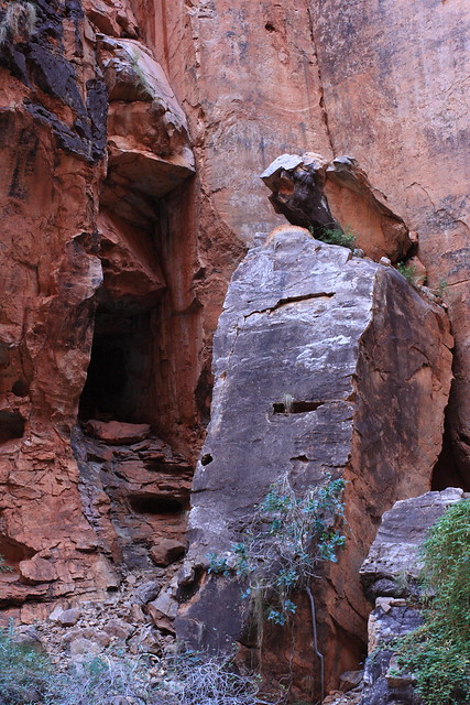
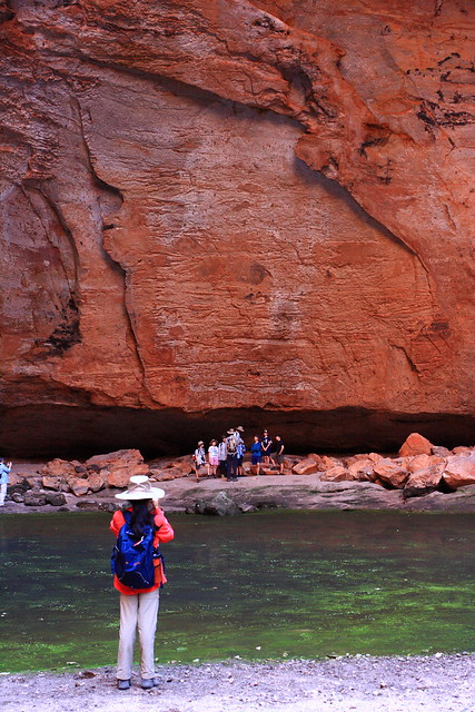
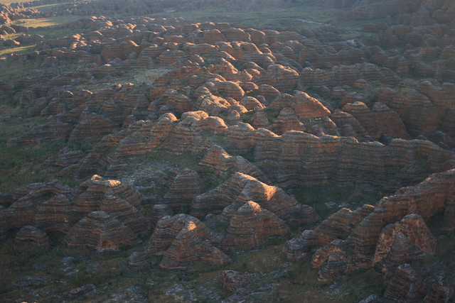
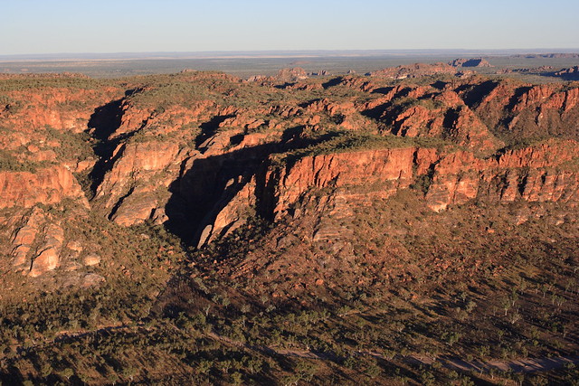
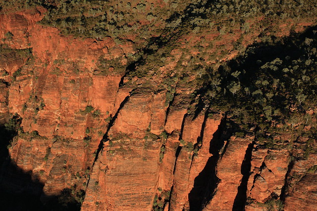
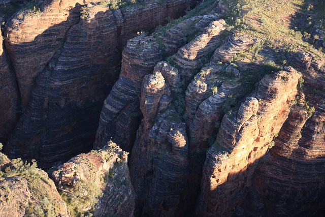
The Bungle Bungles is in Purnululu National Park, on the eastern side of the Kimberley, and the most striking tourist attraction in the region. These orange and black striped domes, like its Central Australian counterparts, are also sedimentary; and at 350 million years old, also ancient. But unlike Uluru and Kata-Tjuta, it’s less visited as it’s a bit more remote. In fact, it was only discovered in the mid-1980’s by a mining exploration team. These days, access is either by 60km of pretty bumpy unsealed road or by air.

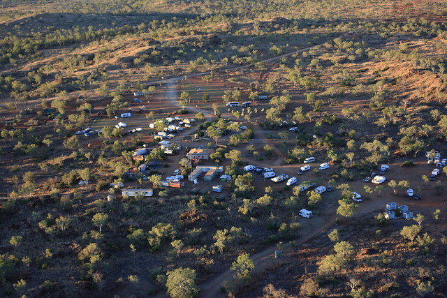
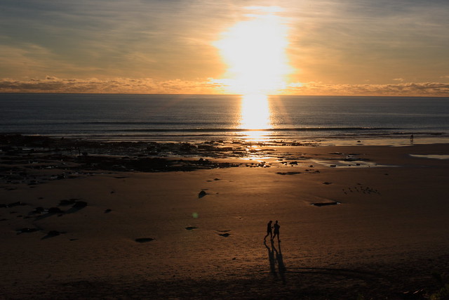
One of the early highlights of our fortnight in the Kimberley was a sunset helicopter ride from our campsite at Mabel Downs to the Bungle Bungles.

Bungle Bungles Helicopter Ride

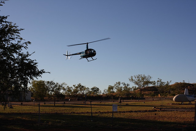
It was an at times hair-raising ride in an open cockpit. The helicopter reached speeds of 180km/h, hence it got pretty breezy up there.

Bungle Bungles Helicopter Ride

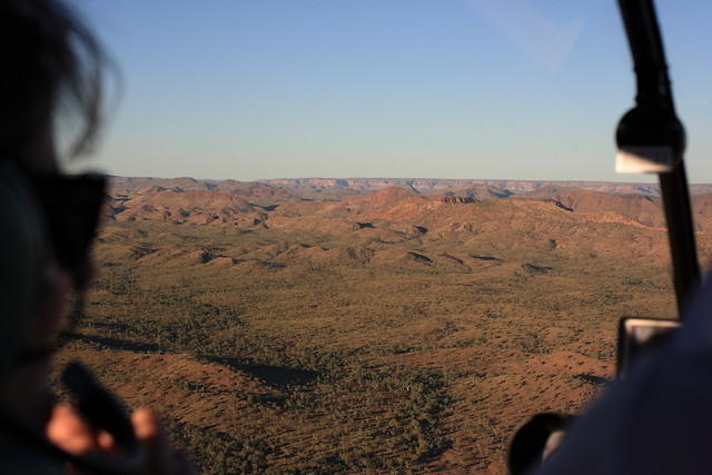
But the views were rewarding.

Bungle Bungles Helicopter Ride

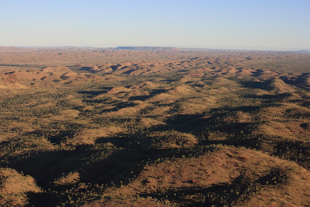
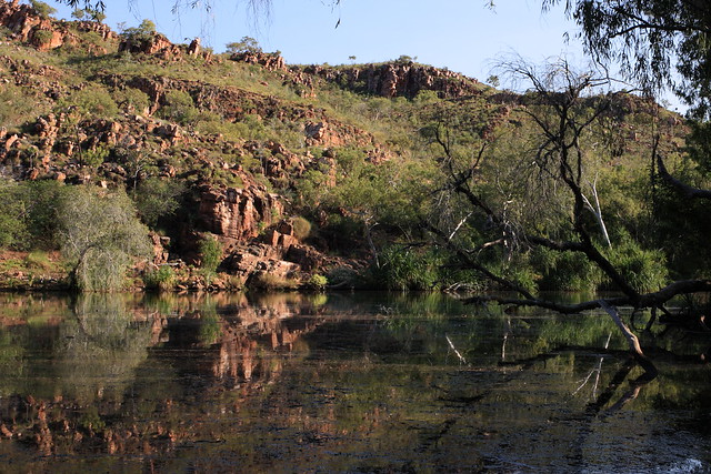
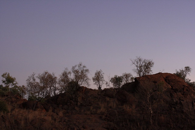
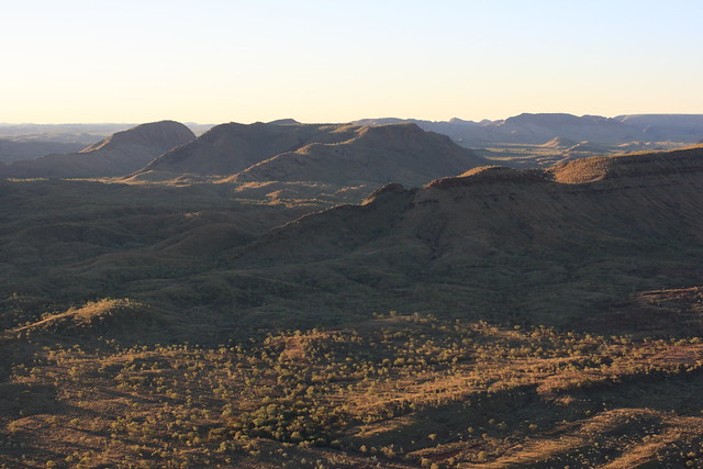
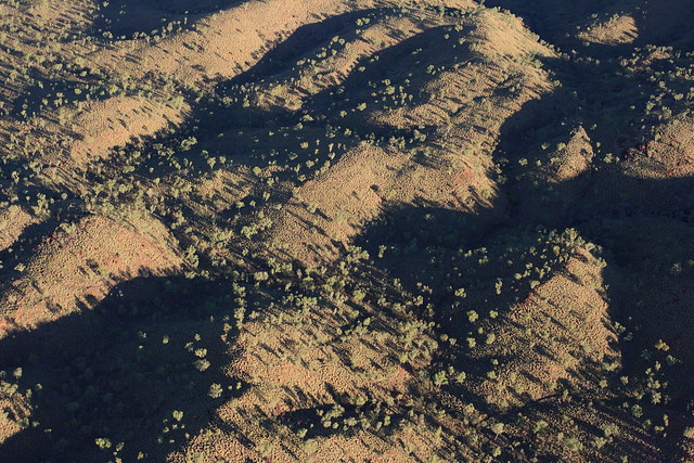
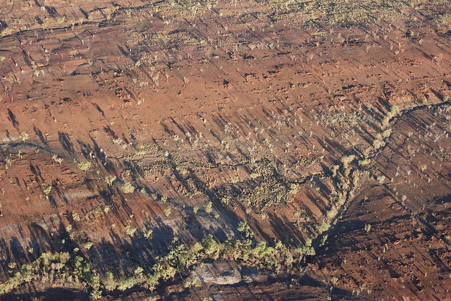
We first flew over the hills, plains and dry river beds of the Ord River. The late afternoon light made the entire landscape glow. You can see from above why the artwork of the local clans are in dots and lines.

Bungle Bungles Helicopter Ride

Bungle Bungles Helicopter Ride

Bungle Bungles Helicopter Ride

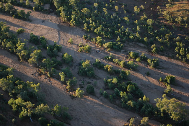
This river winds its way north all the way to Wyndham, some 400km away. We’ll see the river mouth later on, but first, the Bungle Bungles themselves.

Broome in the dry

I’m back from a blog break and holidays to start a brand-new series – our recent trip to the Kimberleys. It’s somewhere I have wanted to go to for a long time, and I was given a chance to go this year as part of the Sydney Grammar School science tour.

We started and ended the trip in Broome. It was a shock flying out of 5C Sydney into 32C Broome, but I bore it somehow. Our hotel was a walk away from Cable Beach, which we got to in time to watch the sunset.

Broome Winter

Broome Winter

The beach is much wider than most East Coast beaches, and pretty busy for WA. It’s the Broome dry season – a season of hot days, mild nights, and generally no rain at all. In fact, we saw clear skies for most of the trip.

Broome Winter

Broome Winter

It got much busier as the sun sunk lower. The 4WD’ers were out in force on the northern half of the beach, eager to get the best seat in the house. It was a bit like Sydney traffic at times.

Broome Winter

Broome Winter

Eventually the sun made its final farewell – the end of our first day.

Broome Winter

Broome Winter

Camping on the Colo – Part 4

The Colo River that morning was misty and mysterious.

Misty Colo

Misty Colo

At Upper Colo, it’s hemmed in by sheer sandstone cliffs and dense bush.

Misty Colo

Misty Colo

By the water, it sustains more verdant species.

Misty Colo

Misty Colo

The river has its source deep in the Blue Mountains north of Lithgow in the valleys of Capertee and Wolgan. We visited the Capertee Valley a few years ago, and by road seems like a world away from Upper Colo.

Glen Davis

The Colo eventually flows into the Hawkesbury, which drains in Broken Bay, so we’ve seen quite a few sides of this extensive river system.

Coastal Stroll

In between, it flows wild through Wollemi National Park, until it emerges at Upper Colo, before meandering into the Hawkesbury at Lower Portland.

Misty Colo

It reminds me of the novel The Secret River. Set by the Hawkesbury in the early days of New South Wales, it described the recreated the experiences of the first white settlers to the area. They saw the river and the bush as a mysterious, menacing creature that was just waiting to gobble them up. Sitting by the river that morning, I think I understood how they felt.

Misty Colo