Tag Archives: western australia

Wyndham – Part 1

We followed the Ord River north-west until it flowed out into the Cambridge Gulf, near the town of Wyndham, 100km of Kununurra. It’s not the only river that flows out here – it’s also the mouth of four other rivers. We had a good look from the (aptly named) Five Rivers Lookout, high above Wyndham.

Wyndham

The landscape here was enormous. The rivers, the gulf, the ranges, and the salt/sand/mud flats seemed to go on forever.

Wyndham

Wyndham used to be a busy port, but the demise of the live cattle industry and mining ended that. On the day we visited, it was receiving its last nickel-ore-carrying ship.

Wyndham

Kununurra and Ord River – Part 3

There were plenty of local fig trees by the Ord. They don’t have to work so hard to get their water.

Ord River Cruise

And also plenty of bird and bat life.

Ord River Cruise

Ord River Cruise

These bats seemed pretty happy in their home, unlike their counterparts in the Royal Botanical Gardens, Sydney.

The further upstream we went, the more rockier the landscape became – all beautiful red sandstone.

Ord River Cruise

Ord River Cruise

It inspired my picture of the day.

Ord River Cruise

Bungle Bungle Walks – Part 2

Our second walk that day was at Echidna Chasm, in the north end of Purnululu National Park. From the car park, the vegetation was all gum trees and scrub. The domes here were less pronounced, however they were taller.

Echidna Chasm walk

As soon as I hit the trail, I noticed that the gum trees disappeared, replaced by a grove of palms.

Echidna Chasm walk

The trail led into Echidna Chasm, and pretty soon its walls were towering over me. The temperature also seemed to drop by 10C.

Echidna Chasm walk

Echidna Chasm walk

Echidna Chasm walk

The path got narrower and narrower. Occasionally we got a glimpse of sky.

Echidna Chasm walk

Echidna Chasm walk

Pretty soon we were in murky darkness, clambering over boulders.

Echidna Chasm walk

At the end, the chasm narrowed into a one metre wide space, and it was so dark that I wasn’t able to get a clear shot. I imagine that in the wet season the entire chasm would be under water. This isn’t a walk for the claustrophobic or with mobility problems! I was pleased to walk back to the entrance and catch a glimpse of sky.

Echidna Chasm walk

Outback Twilight Interlude

At twilight, we took a little walk beyond the tents and Grey Nomad caravans. The land was still, and the sky vast.

Semi Arid Sunset

The trees and shrubs came to life. This leafless acacia tree seemed to reach out at me, like a creature from the deep.

Semi Arid Sunset

Semi Arid Sunset

Then the colours kick in. This pair of boabs made a perfect silhouette to the sunset.

Semi Arid Sunset

It was so pretty that I had to capture it on paper, too.

Semi Arid Sunset

Pioneers of the Kimberley

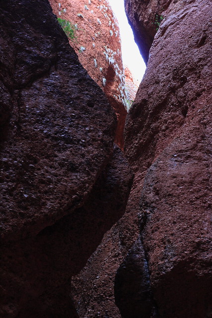
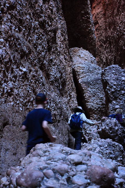
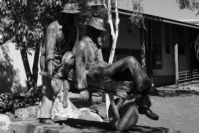
During our tour, we were introduced to the stories of a few pioneers of the Kimberley. First were the miners of Halls Creek’s very brief gold rush in the 1880’s. They had to walk at least 400km to the nearest port down rough and dusty tracks. A character called ‘Russian Jack’ walked this distance with a very sick mate in his wheelbarrow!

Pioneers of the Kimberley

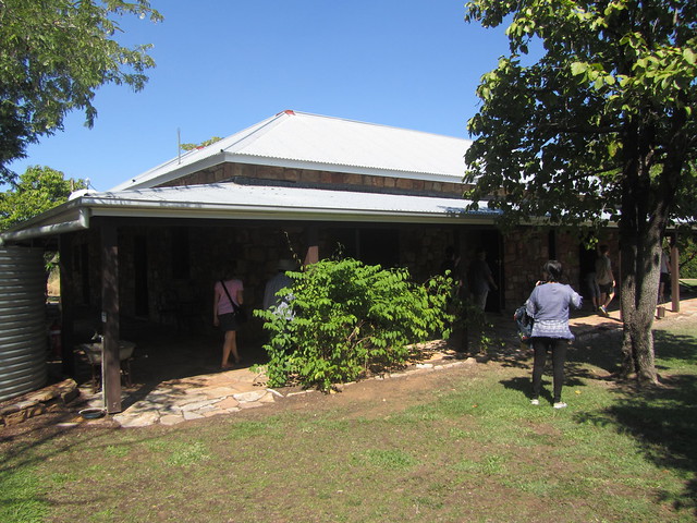
One of the most well-known families of the region are the Duracks, whom I read about in Kings in Grass Castles. They were were cattle owners who drove their mob overland from Goulburn in New South Wales, to the Channel Country in Queensland, and finally to the East Kimberley. Their homestead has been preserved beside Lake Argyle, and it was touching to visit the (surprisingly modest) home where so many legends had lived.

Pioneers of the Kimberley

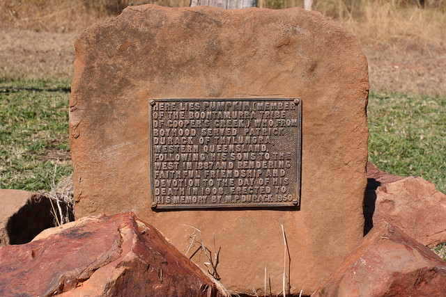
It was touching also to see the grave of the Durack’s indigenous companion, Pumpkin, beside those of the family. Pumpkin was from the Boontamurra tribe of the Cooper Creek district, helped them establish their station, build their homestead, and train the local indigenous lads as stockmen.

Pioneers of the Kimberley

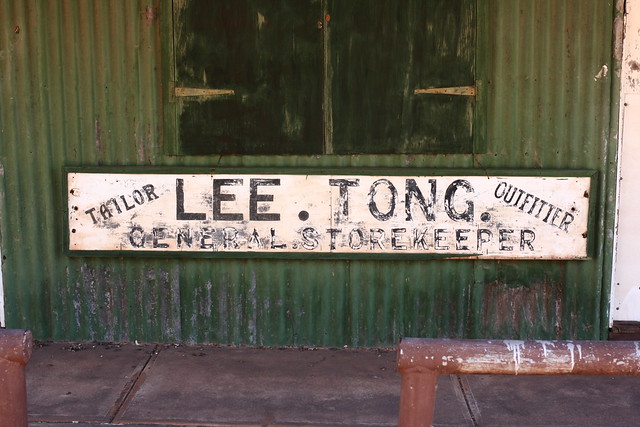
And lastly, there were the Chinese. The first came to the district during the gold rush, but soon found jobs as cooks for droving teams, gardeners at cattle stations, and of course, merchants. This is a well-known shop in the port of Wyndham, first traded at the turn of the 20th century (perhaps earlier), and did a good trade when the town was a vital hub in the region.

Pioneers of the Kimberley//embedr.flickr.com/assets/client-code.js

Geikie Gorge

The next day we started our 14-day Kimberley Camping Safari with Outback Spirit. As we travelled the long road to Fitzroy Crossing, it soon became obvious that the Kimberley was a vast place.

Kimberley Highway

In the late afternoon we arrived at Geikie Gorge. It’s where the mighty Fitzroy River winds its way through the Oscar Ranges – remnants of a Devonian reef that formed 375 million years ago – in an age where land had not yet been colonised by animals, and where giant fish where the most complex life forms in the ocean. Nowadays it’s above water and lovely to cruise along in the late afternoon.

Geikie Gorge

Geikie Gorge

The white rock has been bleached by water during consecutive wet seasons. The red rock is the part of the reef that has oxidised (rusted) in the harsh climate. You can see that the water has carved some interesting shapes.

These pandanus palms can survive whatever the season, dry or wet.

Geikie Gorge

Geikie Gorge

Soon the sun sets, and that’s when the rocks really show off their colours.

Geikie Gorge

Geikie Gorge

Broome in the dry

I’m back from a blog break and holidays to start a brand-new series – our recent trip to the Kimberleys. It’s somewhere I have wanted to go to for a long time, and I was given a chance to go this year as part of the Sydney Grammar School science tour.

We started and ended the trip in Broome. It was a shock flying out of 5C Sydney into 32C Broome, but I bore it somehow. Our hotel was a walk away from Cable Beach, which we got to in time to watch the sunset.

Broome Winter

Broome Winter

The beach is much wider than most East Coast beaches, and pretty busy for WA. It’s the Broome dry season – a season of hot days, mild nights, and generally no rain at all. In fact, we saw clear skies for most of the trip.

Broome Winter

Broome Winter

It got much busier as the sun sunk lower. The 4WD’ers were out in force on the northern half of the beach, eager to get the best seat in the house. It was a bit like Sydney traffic at times.

Broome Winter

Broome Winter

Eventually the sun made its final farewell – the end of our first day.

Broome Winter

Broome Winter

Bunker Bay – Part 1

Bunker Bay is on the northern shore of the Margaret River region. This side of the ‘paddock’ seemed more popular and developed than the Margaret River township – I suspect this was because many folks from Perth have their beach houses in the area.

Bunker Bay though is still in the national park. Development might have be limited, but boy was it popular. Cars were parked cheek to jowl at the cafe nearby even though it was before 11am. We were looking for the beach however, and the one we found was blessingly quiet.

Bunker Bay

Like much of the south west coastline, it was a limestone shore. You can again see the caves being exposed to the air by constant erosion.